What happened
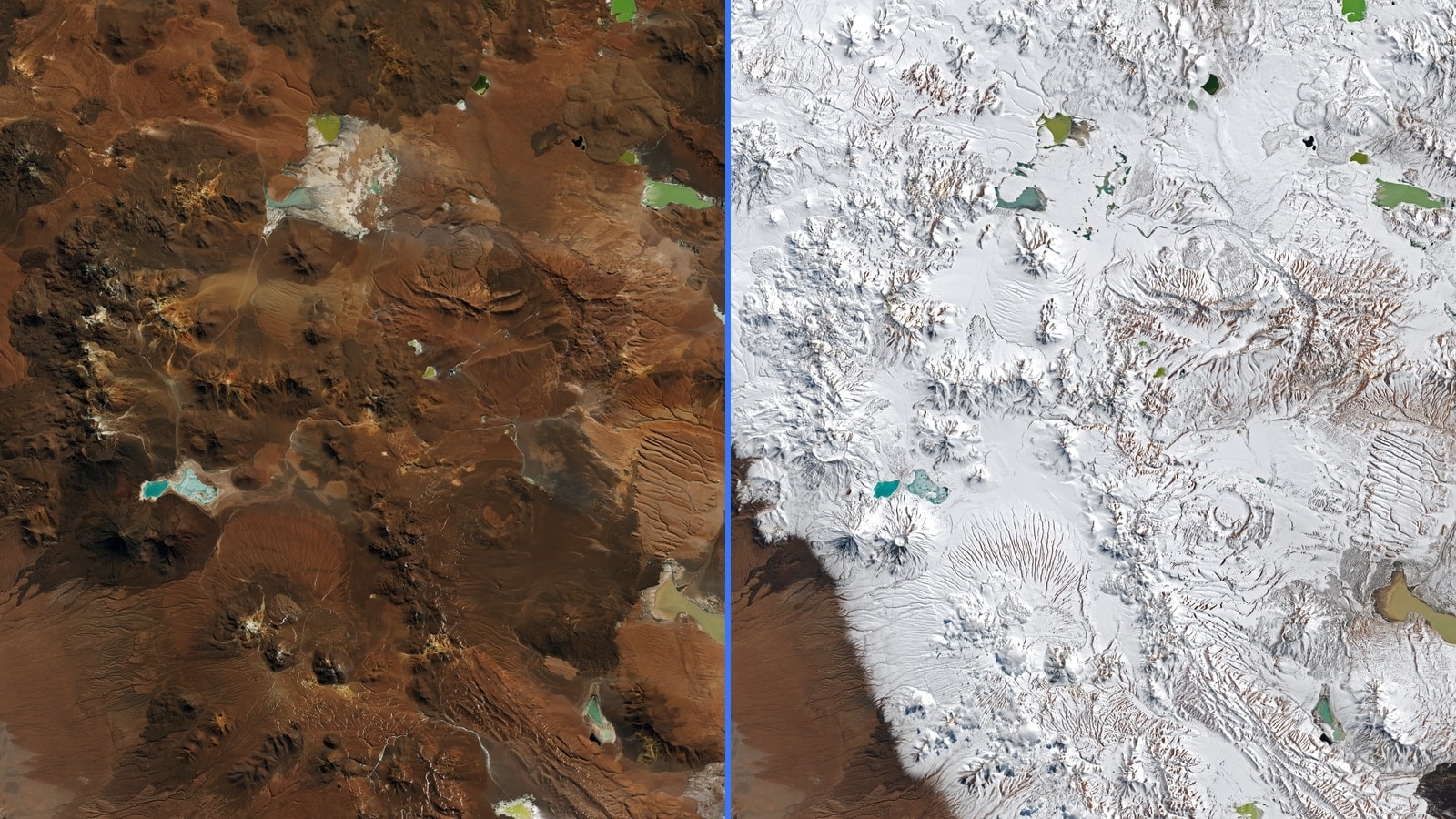
NASA Earth Observatory compared Landsat 8 and Landsat 9 Operational Land Imager scenes acquired on August 6 and August 14. The second view shows extensive snow across normally arid high terrain in northern Chile.
NASA attributes the event to several winter storms that carried moisture into the region. A later Terra MODIS view on August 19 showed snow persisting across parts of the landscape.
The conditions affected high-altitude operations: the Atacama Large Millimeter/submillimeter Array entered survival mode and paused observations. That operational response records the severity at the observatory; it does not by itself quantify a long-term climate shift.
Why it matters
The before/after pair is valuable because it gives the event a stable visual baseline. The same landscape, observed by comparable instruments eight days apart, exposes the geographic reach better than a close weather photograph could. It remains a two-date observation, not an attribution study.
What we're watching
We are watching how long the snow remains, follow-up satellite observations and the return of ALMA operations. Any climate interpretation needs longer records and specialist analysis beyond these images.